|
There is slow progress in Santa Fe when it comes to bicycle amenities. However,
there is very little awareness of what real safe bike paths look like.
A case in point is the Complete Streets plan. The examples linked below merely
show the same thing that has been done in the past, that is having the bikes
share the asphalt with trucks and cars, except that in the 'new' proposals
there is a bit more decorative paint on the asphalt.
A major missed opportunity is unfolding. Cerrillos road between St. Francis and St. Michaels is slated to be rebuilt rebuilt top to bottom. top-to-bottom. There was a public input meeting where several options were shown, including 'option 5', which showed bike paths separated from high-speed traffic. This option was dismissed and 'option 8' was chosen. This option is essentially the same as what is there now, which is quite unsatisfactory. The proposal sketched here would serve to have an on-the-ground example of the kind of bike path that offers real safety. A path where a 10-year old could bike to school and not be mowed down by a pickup truck drifting over the decorative line. | |
2023 links:
| |
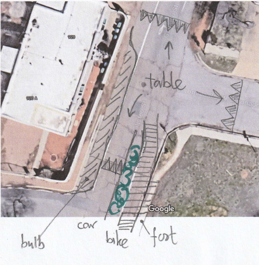
| This is the study area, the portion of Galisteo between Cordova on the bottom to Coronado on top. At the latter intersection, Galisteo narrows considerably at it enters the historic part of town. There are very few residences on the right.
At the stoplight with Cordova, Galisteo turns into a one-way
street all the way into downtown.
The section below was taken at the red line. | 
|
| Typical section: 33 feet curb-to-curb, with a 17-foot wide driving lane marked. On the West side is a 4.5-foot wide sidewalk, 4' on the East side. On each side, 16" from the curb, there is an uneven seam between the asphalt and the concrete of the curb-and-gutter | 
|
| This street is not particularly dangerous for bikes due to its extreme width, though the uneven seams on the surface are annoying, forcing bikes away from the curb. However, all that available asphalt does not cause drivers to naturally go the posted 25 mph limit. | 
|
|
We want not only to build a safe bike path, but also encourage cars
to go slower.
Let's start on the left side, keeping the 4.5' sidewalk in place, plus for now the 8' shoulder. Next comes a 10' lane. Then we place a curb, in order to separate cars and trucks from bikes and pedestrians. Next is a 4' planting strip, planted with chamisa and similar plants. The proximity of these will help to visually narrow the driving lane, as well as make sure the bikes and peds are away from car lane. This leaves about 15' for a combined bike/ped lane, or separate ones with more plantings for separation. |

|
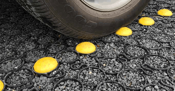
| The shoulder on the left side should not be left wide open, At the intersections with Cordova, Marquez, Fernando and Lomita, there should be 8' bulbouts, clearly emphasizing that the lane width is 10', no more. Of course there should be mid-block bulbouts as necessary. Ideally, the shoulder surface should be paved with a rough-textured material, such as cobblestones, or permeable paving. | 
|
| At the top, where Galisteo becomes narrower, the bike lane and the
car lane have to merge. At the approach to the merge area, there
should be a traffic table, where the road surface bumps up to the
bike path level. Then the two merge and cross the Cordova intersection,
after which the table ends and descends to the old level.
At this stage, the nuisance stop sign is removed, as it no longer
serves its old purpose.
| 
|
Many other streets can be treated like this.
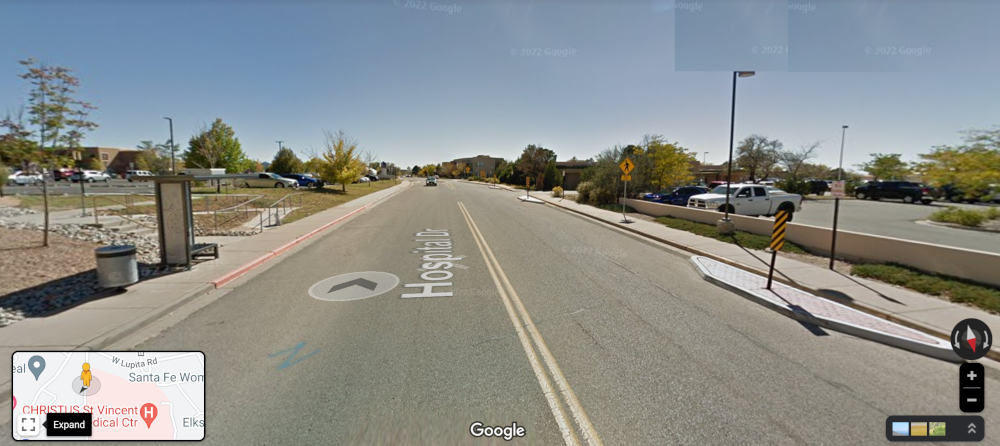
Hospital Drive
and
Alta Vista come to mind.
    Hospital drive:
    curb-to-curb 46'4"
    centerline to bulb 15'8"
    bulb to grass 13'
    sidewalk 6'8"
| 
|
back
Hubert van Hecke
